
 Glossary
AIR MASS: A widespread body of air with consistent temperature and moisture characteristics.
ALBERTA CLIPPER: A storm system that develops near the Province of Alberta in Canada and moves rapidly east-southeast into the Great Lakes and on into the Northeast.
ALTOCUMULUS: A principal cloud type, white and/or gray in color, present in the mid-altitudes with a cumuliform-like shape.
ALTOSTRATUS: A principal cloud type, gray or bluish in color, present in the mid-altitudes with a sheet or fibrous appearance.
ANEMOMETER: An instrument which measures wind speed.
ANTICYCLONE: An area of high pressure around which the winds circulate in a clockwise direction in the Northern Hemisphere. It is usually responsible for fair, dry weather.
APAR - AIRBORNE PHASED ARRAY RADAR: 3D interior views of clouds and severe storms (deployed in 2028).
BACKDOOR COLD FRONT: A cold front that approaches from the north-northeast instead of from the usual west-northwest direction.
BEAUFORT WIND SCALE: A system of estimating and reporting wind speed devised by British Rear-Admiral, Sir Francis Beaufort in 1805, based on observations of the effects of the wind.
BERMUDA HIGH: An area of high pressure centered over the western Atlantic Ocean. This weather system produces a southerly wind which often moves warm, humid air into the Northeast.
BIOMETEOROLOGY: The portion of the science of meteorology that deals with the effects of weather and climate on health and the human body.
BLIZZARD: Severe weather characterized by snow with winds in excess of 35 mph and visibility 1/4 mile or less for 3 hours or longer.
BLOWING SNOW: Wind-driven snow that reduces visibility near the ground. Blowing snow can be either falling snow or snow that has already accumulated but is picked up and moved by strong winds.
CEILING: The height of the lowest layer of clouds reported as broken or overcast and not
CIRRUS: A principal cloud type present at high altitudes above 18,000 feet and composed of ice crystals.
CIRROCUMULUS: A principal cloud type featuring cirrus clouds with vertical development.
CIRROSTRATUS: A principal cloud type featuring cirrus clouds with a flat or sheet-like appearance.
CLIMATE: The statistical collective of weather records during a specified period of time.
COLD FRONT: The front edge of a cold air mass. It often produces precipitation and, frequently, severe weather.
CONDENSATION: The process by which a gas changes into a liquid.
CONVECTION: An atmospheric motion which is predominately vertical. Warm air rising or cold air sinking or both.
CORIOLIS FORCE: An apparent force on moving particles produced by the rotation of the Earth. In the Northern Hemisphere, the wind is deflected to the right by the coriolis force.
CRYOSEISM: (also called frost quake) A sudden soil expansion caused by water that has frozen quickly after seeping into the ground. Loud booms often accompany a cryoseism occurrence.
CUMULONIMBUS: A principal cloud type, dense and vertically developed, which produces heavy precipitation. It features an anvil shape on top and a dark base.
CUMULUS: A principal cloud type of vertical elements having a flat base and a bulging upper portion resembling cauliflower.
DERECHO: A large cluster of thunderstorms that produces widespread, straight-line wind damage.
DEW: Moisture that condenses on objects near the ground.
DEWPOINT: The temperature to which the air must be cooled for water vapor to condense. The larger the spread of temperature and dewpoint, the drier the air. This spread is called the dewpoint depression.
DOWNBURST: A strong localized downdraft of wind that is experienced beneath a severe thunderstorm.
DRIFTING SNOW: The uneven distribution of snowfall. Snow depth caused by strong surface winds.
DRIZZLE: Very small, numerous, slowly falling water droplets, with diameters less than 0.5 millimeters.
EL NIÑO: A large scale weakening of the trade winds and warming of the surface layers in the Equatorial eastern and central Pacific Ocean.
FAIR: Less than 4/10 opaque cloud cover, no precipitation, and no extremes in temperature, visibility or wind.
FLASH FLOOD: A flood which is caused by heavy or excessive rainfall in a short period of time, generally less than 6 hours. These conditions are often produced by slow moving thunderstorms or tropical systems which make landfall.
FOG: The visible aggregate of minute water droplets suspended in the atmosphere near the Earth's surface. A cloud on the ground!
FREEZING RAIN: Rain which falls as liquid then freezes upon impact of a surface, resulting in a coating of ice on exposed objects.
FROST QUAKE: (cryoseism) A sudden soil expansion caused by water that has frozen quickly after seeping into the ground. Loud booms often accompany a cryoseism occurrence.
FROST/FREEZE WARNING: Below-freezing temperatures are expected during the growing season and may cause significant damage to plants and crops.
FROSTBITE: The partial freezing of exposed parts of the body, causing injury to the
skin and sometimes to deeper tissues.
FUNNEL CLOUD: A rotating, funnel-shaped cloud extending below the base of a thunderstorm. When it reaches the ground, it is called a tornado.
GALE: Wind speeds from 39 to 54 mph (34 to 47 knots).
GOES: Geostationary Operational Environmental Satellite.
GUST: A brief, sudden increase in wind speed with a fluctuation greater than 10 knots during a period less than 30 seconds.
GUST-FRONT: The boundary between air flowing into a thunderstorm and the precipitation-cooled air flowing out of the storm. A shelf cloud may be seen above its surface position. There is a noticeable wind shift and temperature drop when the gust-front passes (similar to a cold front).
HABOOB: From Arabic, the meteorological term for a dust storm.
HAIL: Frozen precipitation in the form of layered lumps of ice produced by convection within cumulonimbus clouds.
HEAT ADVISORY: Issued when the Heat Index is expected to exceed 105 during the day and 80 during the night for at least two consecutive days.
HEAT INDEX: Also known as the Apparent temperature, it is a non-physical value which combines the effect of the air temperature and amount of moisture in the air to illustrate how it "feels."
HEAVY SNOW: In general, snowfall is accumulating at the rate of either 4 inches or more in 12 hours or less, or 6 inches or more in 24 hours or less.
HEAVY SURF: Large waves breaking on or near the shore resulting from swells spawned by a distant storm.
HIGH: An area of high pressure around which the wind blows clockwise in the
Northern Hemisphere and counterclockwise in the Southern Hemisphere.
HUMIDITY: Generally the measure of the water vapor content of the air.
HURRICANE: An intense tropical cyclone in the North Atlantic, Caribbean Sea, Gulf of Mexico and the Eastern Pacific Ocean with sustained wind speeds in excess of 74 mph (64 knots).
HURRICANE SEASON: The part of the year having a relatively high incidence of hurricanes. In the Atlantic, Caribbean, Gulf of Mexico, and Central Pacific, the season is from June through November. The season begins two weeks earlier
in the Eastern Pacific.
ICE FOG: (also called frozen fog, pogonip) Fog containing suspended ice crystals. Ice fog can form only in extremely cold areas of the world since water remains a liquid down to -40 �F (-40 �C).
ICE HEAVE: A surge of ice from an ocean or large lake onto the shore, caused by ocean currents, strong winds, or temperature differences pushing ice onto the shore in piles up to 6 metres (20 feet) high.
JET STREAM: Relatively strong winds concentrated within a narrow band in the atmosphere.
LAKE EFFECT: Warm lake water modifies the weather along its shore and for some distance downwind.
LIGHTNING: All of the various forms of electrical discharge produced by thunderstorms.
LOW: A cyclonic storm that often forms along a front, around which the wind blows counterclockwise in the Northern Hemisphere and clockwise in the Southern Hemisphere.
METEOROLOGY: The study of atmospheric phenomena.
NCDC: National Climatic Data Center. The archive center for climate, observational and forecast data from the National Weather Service (NWS).
NEXRAD: Next Generation Weather Radar.
NHC: National Hurricane Center. The office of the National Weather Service responsible for tracking and forecasting tropical cyclones.
NOAA WEATHER RADIO (NWR): The voice of the National Weather Service with 24-hour-a-day broadcasts of weather information, forecasts and warnings. It is programmed from local National Weather Service offices.
NOR' EASTER: An intense low pressure system that tracks along the east coast of the United States, producing strong northeast winds, large waves, and intense precipitation.
NSSL: National Severe Storms Laboratory. Located in Norman, Oklahoma, the office is responsible for monitoring and forecasting severe convective weather. (Storm Prediction Center)
OCCLUDED FRONT: A composite of two fronts that usually occurs when a cold front overtakes a warm front.
OVERCAST: Sky condition when greater than 9/10 of the sky is covered by clouds.
PAROEMIEOLOGY: The study of weather folklore.
POGONIP: A term of Native American origin used for ice fogs occurring in mountain valleys of the western United States.
POLAR VORTEX: The cold-core cyclonic circulation, centered in the Earth's polar regions, extending from the middle troposphere to the stratosphere.
PRECIPITATION: Any form of water particles, liquid or frozen, that fall from the atmosphere and reach the ground.
PRESSURE: The force exerted by the weight of air above a given point, usually
expressed in millibars (mb) or inches of mercury (in. Hg).
QLCS: A Quasi-linear Convective System that produces a very common "spin-up" tornado.
RADAR: A device used to detect precipitation by sending an electromagnetic signal and measuring the intensity of the reflected energy. (RAdio Detection And Ranging)
RADIOSONDE: An instrument connected to a weather balloon that collects meteorological data as it ascends through the atmosphere.
RAIN: Liquid water precipitation generally with a diameter greater than 0.5 mm.
RIDGE: An elongated area of high pressure in the atmosphere.
SCATTERED CLOUDS: A sky condition when between 1/10 and 5/10 of the sky is covered by clouds.
SEA BREEZE: A local wind that blows from a sea or ocean towards land. It is caused by the temperature difference between cool air above the water and the warmer land. The leading edge of the breeze is termed a sea breeze front.
SEVERE THUNDERSTORM: A thunderstorm with wind gusts in excess of 58 mph (50 knots), frequent lightning and hail with a diameter of 3/4" or larger.
SHOWER: Liquid precipitation with frequent changes in intensity or sudden stops or starts.
SLEET: A type of frozen precipitation, consisting of small pellets produced by the freezing of raindrops as they fall.
SNOW: A type of frozen precipitation composed white translucent ice crystals in complex hexagonal forms.
SNOW FLURRY: Also referred to as a snow shower, a very light and brief period of snowfall.
SQUALL LINE: A non-frontal band, or line, of thunderstorms.
STATIONARY FRONT: A transition zone between air masses, with neither advancing upon the other.
STORM SURGE: A rise above the normal water level along a shore caused by strong onshore winds and/or reduced atmospheric pressure. The surge height is the difference of the observed water level minus the predicted tide.
STRATUS: A principal cloud type, gray in color, present at low altitudes with a uniform base.
SUBTROPIC: The climatic region adjacent to the tropics, which are located between 20 and 40 degrees latitude in both hemispheres.
TORNADO: A violent rotating column of air, extending from the base of a cumulonimbus cloud to the ground, producing damaging winds up to 300 mph.
TROPICAL DEPRESSION: A tropical cyclone in which the maximum 1-minute sustained surface wind is 38 mph or less. They form from a tropical wave or tropical disturbance.
TROPICAL DISTURBANCE: A discrete system of apparently organized convection originating in the tropics or subtropics, having a non-frontal migratory character and maintaining its identity for 24 hours or more.
TROPICAL STORM: A tropical cyclone in which the 1-minute sustained surface wind ranges 39-73 mph.
TROUGH: An elongated area of low atmospheric pressure.
WARM FRONT: A leading boundary of a warm airmass that is often moving into an area influenced by a cooler airmass.
WARNING: A public notice issued by the National Weather Service when a certain hazard (tornado, severe thunderstorm, flood or winter storm) is imminent.
WATCH: A public notice issued by the National Weather Service when conditions are such that a certain hazard (tornado, severe thunderstorm, flood or winter storm) is possible.
WATERSPOUT: A column of rotating wind over water that has characteristics of a tornado.
WIND CHILL: The accelerated heat loss from exposed skin due to increased wind speed. A non-physical value which combines the effect of air temperature and the wind speed to illustrate how it "feels."
ACID RAIN: Cloud droplets combining with gaseous pollutants, such as
oxides of sulfur and nitrogen, to make falling rain or snow acidic.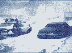
 BAROMETER: An instrument for measuring atmospheric pressure.
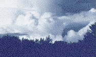 thin.
CLEAR: Sky condition with less than 1/10 cloud coverage.
thin.
CLEAR: Sky condition with less than 1/10 cloud coverage.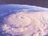 CYCLONE: An area of low pressure around which the wind circulates in a counterclockwise direction in the Northern Hemisphere. It usually produces wet weather. The term is also used for a hurricane in the Indian Ocean.
DOPPLER RADAR: A type of weather radar which displays atmospheric motion. It utilizes the Doppler Effect to measure the velocity of particles in the atmosphere.
CYCLONE: An area of low pressure around which the wind circulates in a counterclockwise direction in the Northern Hemisphere. It usually produces wet weather. The term is also used for a hurricane in the Indian Ocean.
DOPPLER RADAR: A type of weather radar which displays atmospheric motion. It utilizes the Doppler Effect to measure the velocity of particles in the atmosphere. 
 FRONT: The leading edge of an airmass; the transition zone between two distinct airmasses. Frontal types include cold fronts, warm fronts, occluded fronts and stationary fronts.
FROST: Ice crystals produced from water vapor that has frozen on a surface at or below 32ºF/0ºC.
FRONT: The leading edge of an airmass; the transition zone between two distinct airmasses. Frontal types include cold fronts, warm fronts, occluded fronts and stationary fronts.
FROST: Ice crystals produced from water vapor that has frozen on a surface at or below 32ºF/0ºC.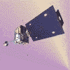 HAZE: Fine dust particles present in a portion of the atmosphere.
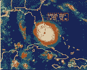 LA NIÑA: A large scale cooling of the surface layers in the Equatorial eastern and central Pacific Ocean.
NOAA: National Oceanic and Atmospheric Administration. A branch of the US Department of Commerce, NOAA is the parent organization of the National Weather Service.
LA NIÑA: A large scale cooling of the surface layers in the Equatorial eastern and central Pacific Ocean.
NOAA: National Oceanic and Atmospheric Administration. A branch of the US Department of Commerce, NOAA is the parent organization of the National Weather Service. PARTLY CLOUDY: Sky condition when between 3/10 and 7/10 of the sky is covered by clouds.
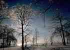 RELATIVE HUMIDITY: The percent of the amount of water vapor in the air compared to the capacity for water vapor in the air.
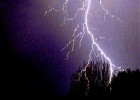 SNOW SQUALL: Intense showers or bands of locally heavy snow, often produced by the lake effect.
THUNDER: The sound produced by a stroke of lightning as it rapidly heats the air surrounding the bolt.
VIRGA: Falling precipitation that evaporates before reaching the ground.
SNOW SQUALL: Intense showers or bands of locally heavy snow, often produced by the lake effect.
THUNDER: The sound produced by a stroke of lightning as it rapidly heats the air surrounding the bolt.
VIRGA: Falling precipitation that evaporates before reaching the ground.
 Please read our Legal Notice and our Privacy Statement.
 CapeCodWeather.com